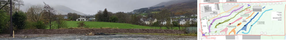
Clonmany Historical Flooding
Published : 25th Nov 2024
The lack of historical flooding with regard to Clonmany in the 2018 Office of Public Works North Western Flood Risk Management Plan Report is alarming. This Clonmany Historical Flooding section in tandem with a Flooding Feedback section aims to provide the Office of Public Works with relevant Historical Flooding Information for the Clonmany region.
This OPW Flood Risk Management Plan Report has assessed Clonmany as a low/no risk AFA ( Page 13 ). The OPW report lists no historical flooding history for the region ( Page 23 & 24 ) and informs us that there are no hydrometric gauges in the area. Yet, we are informed that the 'Ballynahallan River' is a 'significant flood risk' and that this river would benefit from the installation of new hydrometric gauging stations ( Page 76 ).
The 2018 OPW Flood Risk Management Plan Report historical analysis for 26 AFA's in Donegal covers the following time period : 1828 - December 2015, 188 years. Historical flooding events have been assigned to 25 of the AFAs in Donegal by date or 'Recurring' tag. Clonmany has been assigned the 'No Results' tag.
This Clonmany Historical Flooding (non-exhaustive) section includes details on
- multiple Cloudbursts
- multiple Bursting of Riverbanks
- multiple Landslides
- Clonmany Community Centre flooding
- Clonmany Wastewater Treatment Plant flooding
- Clonmany Shamrocks FC facilities flooding
- multiple House and Business flooding
- Riverside Park Estate flooding ( Defective Blocks )
- Big Bridge partial destruction (2017) & four bridges swept away (1945)
- Glenevin Walk destruction
- livestock fatalities
- 'narrow escapes' & near fatalities
- the unfortunate fatality of a young boy, swept away in a historical flood
The floods of 23rd Nov 2018 (Malin Head Rainfall 10.5mm) and the 10th May 2019 (Malin Head Rainfall 17mm) highlight the need for a managed solution of clearing debris from the Clonmany River. In Malin Head, there has been 1790 days of daily recorded rainfall of 10.5mm or more between 1st May 1955 and 31st Dec 2024.
10th May 2019 : Clonmany Village

Homes in Clonmany narrowly escaped flooding on Friday afternoon following torrential rain.
The nearby river, overwhelmed by the heavy rainfall, burst its banks.
Local residents made a desperate effort to prevent water from entering their homes.
This area was previously severely impacted by devastating floods in August 2017.
There are claims that relevant authorities consistently fail to address the issue of clearing debris from local rivers.
Homes in Clonmany under threat from flash flooding yet again - Highland Radio News - 13/05/2019
23rd Nov 2018 : Clonmany Village

It’s been claimed that the river in Clonmany is more blocked with debris now than it was when devastating flooding hit the Inishowen peninsula in August 2017.
In recent weeks, a number of houses in the village narrowly escaped being flooded again after a day of heavy rain caused the river there to burst its banks.
A local Councillor believes that the issue would be resolved somewhat if efforts were made to clear the river from excess debris.
He says it’s a countywide issue, that neither Donegal County Council nor the OPW are taking responsibility for:
Concern over flooding potential of blocked Clonmany river - Highland Radio News - 23/11/2018
22nd Aug 2017 : Clonmany Parish

Devastating flooding hits the Inishowen peninsula in August 2017.
“it’s a miracle that nobody drowned”
Flooding, miracle & drowning reference.
Mickey Devlin (2:53) - Timeline Link - Redaction Explanation
The flood devastation and destruction in Clonmany included
- Bursting of Riverbanks
- Clonmany Community Centre flooding
- Clonmany Wastewater Treatment Plant flooding
- Clonmany Shamrocks FC facilities flooding
- multiple House and Business flooding
- Riverside Park Estate flooding ( Defective Blocks )
- Big Bridge partial destruction
- Glenevin Walk destruction
- livestock fatalities
- near fatalities
In pictures: The night Donegal was devastated by floods - Donegal News
Donegal Co Co continues flood damage assessment - RTE
Clonmany Flood Damage : Michael Devlin speaks to Pat Kenny - Newstalk
5th Dec 2015 : Clonmany Parish
Crossconnell, Binion, Clonmany, Tullagh flooded.
Source : Mamie Grant.

This is the highest daily rainfall, 80.60mm, measured at Malin Head for records published 1955-05-01 to 2023-12-31.

24th July 1959 : Bulaba (Bulbin) and Raghtin

Thousands of Tons of Rock Crash Down Mountainside
HOUR OF TERROR FOR INISHOWEN FARMERS
Landslide, Floods Cause Heavy Damage
FARMERS in the Clonmany district of Inishowen are still trying to assess the damage caused by the weekend cloudburst at Bulaba Mountain, where a freak storm about three o’clock in the afternoon led to the worst flooding the district has known for years.
A FALL-OUT on Bulaba and the adjoining Rachtan mountain literally tore tracts out of the mountain sides and transformed small streams into raging torrents. Thousands of tons of rock were carried down the mountains and a number of small farmsteads had narrow escapes.
Derry Journal

No rainfall recorded in Malin Head. Localised cloudburst in Clonmany.
Sept 1952 : Crossconnell
In September 1952, heavy rain caused the Clonmany riverbanks to break, flooding corn fields, especially around Crossconnell.
Clonmany - Floods, storms, beaches and dangerous sea currents - Wikipedia
August 1952 : Clonmany
In August 1952, heavy rain and high tide flooded the village itself.
High tide and heavy rains. Flooded houses in the village.
"Cloudburst in Clonmany". Donegal News. 23 August 1952.
Clonmany - Floods, storms, beaches and dangerous sea currents - Wikipedia
25th October 1945 : Clonmany
In October 1945, four bridges over the Clonmany river were swept away, dislocating traffic between Clonmany and Buncrana.
"Bridges collapse". Belfast Newsletter. 25 October 1945. p. 3.
Clonmany - Floods, storms, beaches and dangerous sea currents - Wikipedia
26th September 1924 : Clonmany
Significant flooding occurred in 1924.
“Flooding in Clonmany District”. Derry Journal. September 26, 1924
Clonmany - Floods, storms, beaches and dangerous sea currents - Wikipedia
December 1894 : Clonmany
In December 1894, another storm damaged church roofs and blew away thatched cottage roofs, destroying agricultural production.
"The storm in Clonmany". Derry Journal. 28 December 1894
Clonmany - Floods, storms, beaches and dangerous sea currents - Wikipedia
28th May 1892 : Clonmany
On 28 May 1892, three hours of torrential rain led to the breaking of Clonmany river banks, flooding hundreds of acres and causing crop and livestock losses.
"Great Floods in Innishowen". Derry Journal. 30 May 1892.
Clonmany - Floods, storms, beaches and dangerous sea currents - Wikipedia
1st August 1889 : Clonmany
Death of Michael Carroll, 7-year-old son of local RIC man, who drowned during Lammas tide flooding.
It has been retold that Michael was seen by old Master Randal being swept under the bridge, but by the time the alarm was raised, the body was washed down as far as the White Gates in Binion.


Topographical Characteristics Analysis
ChatGPT : Analysis of Topographical Characteristics that can increase the chance of Cloudbursts or Heavy Rainfall in Clonmany
Clonmany, in Inishowen, County Donegal, Ireland, exhibits several topographical and environmental features that could contribute to the likelihood of heavy rainfall or even localized cloudbursts under certain conditions:
- 1. Mountainous Terrain and Uplift
- Nearby Mountains: The Urris Hills and surrounding elevations in the region create conditions for orographic lifting. Moist air from the Atlantic is forced upward as it encounters these hills, cooling and condensing to form precipitation.
- Localized Uplift: The steep inclines of the Urris Hills enhance the orographic effect, especially when strong westerly winds drive moist air inland from the Atlantic.
- 2. Proximity to the Atlantic Ocean
- Abundant Moisture: Clonmany's close proximity to the Atlantic Ocean ensures a steady supply of moist air. Warm ocean currents, such as the North Atlantic Drift, enhance the moisture content of the air masses approaching the region.
- Storm Systems: The North Atlantic is a breeding ground for low-pressure systems, which frequently bring heavy rainfall to Donegal. When combined with local topography, these systems can produce intense precipitation.
- 3. Valleys and Drainage Patterns
- Presence of Valleys: The Clonmany area features valleys, such as those formed by the Ballyhallan and Ballyliffin rivers. These valleys can trap moisture-laden air, intensifying rainfall.
- Drainage Network: Rivers and streams in the area could be overwhelmed during heavy rainfall events, particularly if cloudbursts occur, leading to localized flooding.
- 4. Coastal Topography
- Interaction with Winds: The coastline near Clonmany faces strong prevailing winds, which often interact with the land. When these winds hit coastal cliffs and hills, the resulting uplift can trigger precipitation.
- Sea Breezes: The interaction of sea breezes with the land can create localized convergence zones, enhancing rainfall intensity near the coast.
- 5. Influence of Steep Elevation Changes
- Foothills Leading to Mountains: The gradual rise from lowlands to the Urris Hills can create sharp contrasts in elevation, fostering strong upward air currents. This contributes to localized heavy rainfall events.
- Enhanced Convection: On sunny days, heating of the lower slopes can cause thermal updrafts, which, combined with moist air, may trigger heavy showers or thunderstorms.
- 6. Latitude and Climatic Factors
- Temperate Maritime Climate: The region’s climate, characterized by frequent rainfall, is influenced by its latitude and proximity to the Atlantic. Periodic instability in the atmosphere (e.g., troughs of low pressure) can lead to heavy rainfall events.
- Tropical Air Influence: Occasionally, tropical air masses from the south interact with cold polar air near Donegal, creating strong atmospheric instability that could lead to intense rainfall.
Conclusion
Clonmany's topography and geographical features make it particularly susceptible to heavy rainfall. The orographic lifting caused by the Urris Hills, combined with moist air from the Atlantic, creates an environment conducive to frequent and sometimes intense precipitation. While full-blown cloudbursts are rare in temperate regions like Ireland, localized heavy rainfall events, driven by these topographical and climatic factors, are a significant possibility.
Understanding these risks is critical for managing potential flooding and other impacts in the Clonmany area.
The '24th July 1959 : Bulaba (Bulbin) and Raghtin' historical section clearly shows that the Bulaba (Bulbin) and Raghtin cloudburst in Clonmany in 1959 corresponded with zero rainfall being recorded in Malin Head. Thus, the historical rainfall records in Malin Head are only indicative of the flooding in Clonmany. Their Topographical differences lead to different rainfall patterns.
ChatGPT : Comparison of potential Rainfall in Clonmany and Malin Head.
Between Clonmany and Malin Head, Clonmany is likely to receive a greater amount of rainfall on average. This can be attributed to the following factors:
- 1. Topographical Features
- Clonmany:
- Surrounded by the Urris Hills and other elevated areas, Clonmany experiences significant orographic lifting, which enhances precipitation as moist air from the Atlantic is forced to rise and cool. Valleys and lower-lying areas in Clonmany can trap moist air, leading to prolonged and concentrated rainfall.
- Malin Head:
- While Malin Head has rugged coastal cliffs, it lacks significant elevation and large-scale mountainous features that could enhance orographic rainfall. The flat, open terrain allows rainclouds to pass through more quickly, leading to less concentrated rainfall.
- 2. Rainfall Mechanisms
- Clonmany:
- The combination of mountains, valleys, and varied elevation creates more opportunities for localized, heavy rainfall.
- Convergence zones in valleys may trap moisture-laden air, allowing for extended periods of rain.
- Malin Head:
- Rainfall at Malin Head is driven primarily by frontal systems and convective activity, which tend to produce shorter, intense bursts of rain rather than prolonged heavy precipitation.
- The flat terrain prevents the accumulation of moist air in the same way as in Clonmany.
- 3. Wind and Exposure
- Clonmany:
- Protected somewhat by its hills, Clonmany allows moist air to linger longer, resulting in more rainfall.
- Malin Head:
- Being the northernmost tip of Ireland, Malin Head is fully exposed to strong winds from the Atlantic. While these winds bring moist air, they also push weather systems through quickly, reducing the likelihood of prolonged rainfall in one spot.
- 4. Climatic Influences
- Both regions share a temperate maritime climate influenced by the Atlantic, with frequent rainfall. However:
- Clonmany: The terrain interacts more dynamically with moist air masses, enhancing precipitation totals.
- Malin Head: Experiences intense but often brief rainfall due to its exposed location and lack of significant elevation changes.
- 5. Rainfall Observations (Empirical Data)
Historically, rainfall measurements tend to confirm that areas with mountainous terrain, like Clonmany, receive higher annual rainfall totals compared to flatter, exposed coastal regions like Malin Head. Clonmany’s proximity to the Urris Hills makes it a natural rain catchment.
Conclusion
While both Clonmany and Malin Head are prone to frequent rainfall due to their location on the Inishowen Peninsula, Clonmany is better positioned to receive greater overall rainfall amounts due to its mountainous terrain, orographic effects, and the ability of valleys to trap moist air.
Malin Head, on the other hand, may experience more frequent rain showers, but these are typically shorter and less intense in total accumulation compared to the persistent rainfall in Clonmany.
Sources of Historical Malin Head Weather Data
MET Éireann - Daily Weather Station DataMalin Head Daily Data - Data.Gov.ie