Onsite Development
Embankment Enlargement
Published : 28th Nov 2024


It is abundantly clear from this photographic evidence, that there has been onsite development since the planning application was lodged (05/03/2024). The embankment has been enlarged in both height and depth.
As a consequence, the enlargement of this riverside embankment escalates and intensifies these amplified flooding concerns raised in the planning objection.
- Potential Amplified Flooding of multiple Elderly Residents
- Potential Amplified Flooding of Riverside Park Estate (50+ Defective Blocks Homes)
- Potential Amplified Flooding upstream of Shamrock Park (Clonmany Shamrock FC) and the adjacent Clonmany Community Centre
- Potential Amplified Flooding upstream of Clonmany Wastewater Treatment Plant
It is incredulous and bewildering that a riverside embankment was built in the Parochial Field after the exceptional floods of 2017. Increasing the height and depth of the Riverside Embankment after these amplified flooding concerns were raised in a planning objection is mind-blowing, frightening and distressing. What type of message does this send to the local community, especially the at-risk elderly residents and the Defective Blocks affected residents?
It can only be assumed that the vast amount of topsoil and subsoil removed in the 2017 development work, provided more flood relief than normal in the Parochial Field during the 2017 flood. By erecting this Riverside Embankment and the further enlargement of it, this embankment could direct more and faster floodwater to the bottom of the village. This has the potential to lead to additional debris build up at the Big Bridge bottleneck.
The recent (Oct/Nov 2024) instantaneous, rapid, violent and torrential floods in Valencia, Central Eastern Spain and Malaga are a warning that we should not ignore. The fatalities and destruction bear witness to that. Storm Bert (23/11/2024) has emphasized the potential lethal combination of torrential rain and melting snow. The Killybegs flooding (23/11/2024) within our county borders, reawakens unwelcome memories and concerns.
The future flooding implications due to the development of this riverside embankment needs to be investigated immediately.


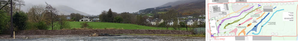
These comparative images show a clear and undisputable timeline of the development of the riverside embankment at the bottom of the Parochial Field. The Defective Blocks infected Riverside Park Estate can be seen in the background.

Is it permitted to carry out on-site developments in the course of a planning application? If development work is carried out onsite during the planning application process, does this nullify the planning application?
If work is carried out onsite during the planning application process, does this give the local authority the option of revoking the previously granted planning permission?
Planning and Development Act 2000. 44. Revocation or modification of permission.
If work is carried out onsite during the planning application process and if it reported to the local authority, is the local authority duty bound to investigate the alleged onsite development?
As the elderly residents at the bottom of the village would appear to be at the highest risk of flooding, could this embankment put them at an increased risk of flooding in a non-exceptional flooding situation? This needs to be investigated immediately.